Take Your Real Estate Business to New Heights with Drone Maps
Accurately Assess Properties and Maximize Your ROI with High-Quality Aerial Data
WE PROVIDE THE HIGHEST QUALITY MEDIA FOR YOUR LISTING NEEDS
Our 2006 company is a leading provider of drone maps for real estate businesses. Using the latest technology, we capture high-quality aerial data to create detailed maps, 3D models, and surveys that can help you accurately assess properties and make more informed decisions. Our drone maps service is perfect for real estate agents, property developers, and investors who want to maximize their ROI and minimize risk.With our drone maps, you can gain a better understanding of your properties, including their boundaries, dimensions, and topography. You can also use our maps to identify potential hazards, assess infrastructure, and plan for future development. Our drone maps service is customizable to meet your specific needs, whether you need a basic map or a more detailed 3D model.
* Accurate and up-to-date information on properties
* Detailed 3D models for better visualization and planning
* Identification of potential hazards and infrastructure issues
* Cost-effective and efficient compared to traditional surveying methods
* Customizable to meet your specific needs and requirements
* Helps you make more informed decisions and maximize your ROI

Capture every angle of your listing. Add Aerial drone images to your listing package. We turn around your photos in 24 hours, so you can get your property listed quickly.

Capture the vibe of the property with stunning 4K video. Whether it's drone footage of an expansive ranch or an intimate walk-through of a cozy home, we show your listing in the best light, helping it to get the attention it deserves.

Our Matterport tours give viewers an immersive, 3D experience of every single space on a property, letting buyers see it from nearly any imaginable angle. Even better, a built-in tool lets viewers measure a space to see if their furniture and decor will fit. And the tour can be used to generate a schematic floor plan.
.png)
An empty space makes it difficult for people to imagine themselves in a room. And real-life staging can cost some serious dough. Let us enhance your photos with contemporary furniture and decor.
.png)
Whether it's new construction or just cluttered spaces, let us “clean up” your photos. Whether the listing needs a greener lawn, some construction cleanup, or a different paint color, we can transform your photos to look just the way you want.
.png)
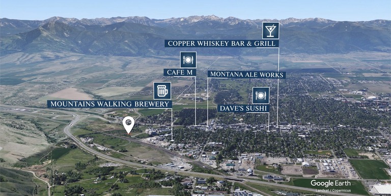
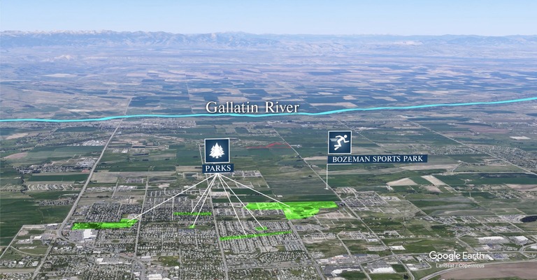
A perfect complement to a real estate video. We use Google Earth to show your listing’s location and how far it is from town, from local recreational opportunities, airports or other places of interest. You can highlight exactly the parks, schools or other amenities that appeal to your ideal buyer.

His photos were very high quality and we received praise from publishers we advertise with for Ryan's work. Highly creative, he always added small touch to the scene to enhance the impact of the photography. Early 2008 I started a new video project and Ryan was absolutely the right resource. Not only he is a great photographer but also makes great videos.

"I have used Ryan as my photographer/designer exclusively in the marketing of high-end homes in Maui for the last few years. It was always a pleasure dealing with him and I only had positive experiences. I found him to be motivated, well-informed, reliable and always willing to go above-and-beyond to provide a great service."
Over the years I have watched you lead in your marketplace with the best of marketing knowledge and practice. What I have seen you do with real estate photography, video and web development continues to amaze me each and every year. You’re an amazing example of how real estate agents can get an edge over their competition!"